- Size : > 50 km²
- Type : peri-urban
- English Title : Hunting Map
- Type Of Study Area : Preparing Plan
- Form Of Publication : Printed Version
- Time Horizon Of Plan : > 10 years
- Legislative Framework : King Louis XV. Engraving was commishionned y Louis XVI.
- Preparation : 0000
- Approval : 0000
- Reason/Motivation For Preparing The Plan : Legal Requirement
- Main Planning Scale : > 1:10000
- Status Of Plan : Preparatory for Further Plans
- Location : Versailles, FR
- Other Planning Agencies/Bodies Involved : Ingeneers-geographers
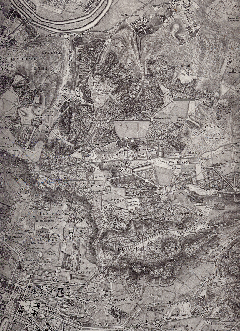
- Image Title : Hunting Map 1770
- Image Desc : The precision of the details, the drawing of the ground, the expression of the vegetation and agriculture, the very fineness of the engraving give it a grey velvet aspect contrasting with the white network of the roads. This masterpiece leaves behind many contemporary productions.
�������������������������������������������������������������������������������������������������������������������������������������������������������������������������������������������������������������������������������������������������������������������������������������������������������������������������������������������������������������������������������������������������������������������������������������������������������������������������������������������������������������������������������������������������������������������������������������������������������������������������������������������������������������������������������������������������������������������������������������������������������������������������������������������������������������������������������������������������������������������������������������������������������������������������������������������������������������������������������������������������������������������������������������������������������������������������������������������������������


