


There where the many arms of the Danube once meandered, a rich plant
world grew on marshy alluvial land. Floodplant forest were first and foremost
threatening because of the impact of the floods. It was solely as a result of
the shortage of space that the up -and-coming Vienna spread increasingly to the
north. The Danube was increasingly canalized and streets and tracks in the fopw
path were constructed with crossing bridges. On the newly won land passanger
and freight train stations were constructed. On the site of the former North
Train Station, the oldest of the once six large long-distance train stations in
Vienna, a new city expansion district is now being created with
Rudolf-Bednar-Park at its center.<br><br>In December 2005 the design
office Hager Landschaftsarchitektur AG were invited to take part in the
competition for the realization of Rudolf-Bednar-Park. After four months the design office received the 1st prize. The task was to design a contemporary park for a district that had not yet been constructed (Hager et al., 2008).<br><br>Planning phase
from August 2006 to March 2007<br>Opening of the
park in September 2008
<br>
Project
management: Patrick Altermatt
<br>
Design
management: Guido Hager
<br>Competition: Pascal
Posset
- Address : Fanny-Mintz-Gasse
- Area : 3,1721
- GPS X : 16.396755500000040000
- GPS Y : 48.226145600000000000
- Project start : 2005
- Project end : 2007
- Implementation start : 2007
- Implementation end : 2008
- Context : The Rudolf-Bednar-Park is a new district park on the site of
the former North Train Station. A new city expansion district is now being
created with Rudolf-Bednar-Park at its center.
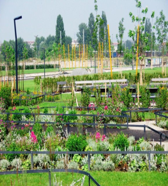
As the primary level, a clear park structure made up of paths
and esxpanses of lawns links the individual areas of the park to each others as
well as the park to its urban surroundings as a whole. This structure ensures
that the park space is embedded in its urban environment. Establishing
Rudolf-Bednar-Park as a component of the Danube floodplain in the urban space
is the basic concept. As a result, the main pathway traverses
the park in a southeast direction from Leystraße in the south in order to lead park
visitors through the site and then discharge them into the city again on Radingerstraße.
Two additional park pathways proceed in the same direction and are aligned with
the northeastern and southwestern edges of the park (Hager et al., 2008). - Website : http://
- Project Status : Completed Project
- Client : City of Vienna, EU-sponsorship
- Ownership : Public
- Accessibility : Unrestricted areas
- Project Team : Andreas Albrecht, Armin Kopf, Gregor Fuerniss, Susanne Fuege, Leonard Saal, Mauro Hagel, Lena Knufinke, Karol Kruk, Cornelia Felder, Martin Hellbach, Alexander Rauw
- Notes : The nearest bus station is on Ernst-Melchior-Gasse (82A) and on Vorgartenstraße (11A, 11B) as well as the underground station Vorgartenstraße (U1).
- Brief Description : In the 2nd Viennese city district a new quarter of 75 ha will be created on the area of the former northwest station until 2025. At the beginning of this development the planning and realisation of a 3.1 ha park on the north-eastern side of the former railway premises took place. The park as the green lung of the District completes the existing grand open spaces like Augarten and Donauinsel. Hager Landschaftsarchitektur was the winning office of the international EU funded competition to design the Rudolf Bednar Park. The most important design element consists of a veil of trees of 280 plants. By means of this veil the impression of the place in its proximity to the river Danube and as an urban pattern remains spatially readable. Also the linear water basins with its different plants are reminiscence to the nearby stream. During the night light-bands under water additionally enhance the linearity. Specified activity-zones in the northeast and southwest of the park bordered by self-binding gravel surround a more quiet lightly planted lawn space in the centre. Game and sport areas, zones for communication or skaters allow for broad fields of activity for different user groups (Hager et al., 2008).
- Designer : Hager Landschaftsarchitektur AG
- Location : Austria, Wien, lat : 48.226145600000000000 - lng : 16.396755500000040000 address : Rudolf Bednar Park, 1020 Wien, Austria
- Project Name : Original : Rudolf-Bednar-Park
- Type : Local recreation areas, Local recreation areas
- Image Title : Rudolf-Bednar-Park


